Quetta: August 5, 2023
(Saeed Yousuf)
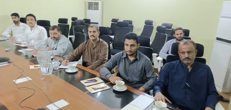
The Balochistan Integrated Water Resources Management and Development Project (BIWRMDP) M&E section conducted a one day Training session on Geospatial / GIS Technology and it’s Usage in Survey for the BIWRMDP, PMU & PSIA teams. The event was facilitated by M&E Specialist BIWRMDP Mr. Muhammad Anwar and Provincial Team lead MMP M&E Dr. Faiz Kakar.
Speaking on the session the Project Director BIWRMDP, Engineer. Barkat Ullah Kakar said that, these kinds of innovative technological awareness sessions about Geospatial technology and its usage in survey techniques and alike will boost up the technical expertise of the team, and hoped that knowledge gained from this session will undoubtedly be instrumental in advancing the project’s goals and fostering a brighter water future for Balochistan. But ,also the BIWRMDP continues its mission to improve water management and development practices in Balochistan. Even so, after this session the team will be also be able to use these techniques into the field in a pragmatic manner. In last, Engineer Barkat Ullah Kakar affirmed that such and many more capacity building Trainings will be arranged for the PMU & PSIA teams in the near future where the team cherished and showed their enthusiasm to give there’s best.
The trainers grasped with all the thematic areas that are used in the Geospatial and GIS techniques to the officials of BIWRMDP (PMU) & PSIA team. Elaborating more the Trainers said that, in understanding geospatial surveys, it’s important to know what makes up geospatial data which is usually made up of the following five components that includes Vector Data, Raster Data, Attributes, Geographic Coordinate System and Georeferencing. Trainers asserted that, these components may be used in isolation or in combination with one another. When it comes to surveying, this data is extremely useful to contractors or engineers working on large-scale projects. This is because geospatial surveying provides a comprehensive analysis and complete view of the surrounding environment.
Trainers also said that this is a rather complex and multi-dimensional type of land surveying service. While it does involve traditional land mapping and mobile mapping, it also involves various other disciplines. They said, It offers multiple data formats to provide the exact data you need. Geospatial technology systems broadly include mapping and surveying techniques like global positioning systems, geographic information systems, remote sensing, etc. this system has a unique ability to store, label, and analyze information using spatial systems.
Trainers also shared knowledge regarding the Geographic Information System (GIS) and said that it is a method of data collection that provides spatial information. Ultimately, GIS connects data to a map to show either location data or descriptive information . And , GIS provides a central system to store and view land data. It helps surveyors to easily manage survey information and provide the necessary data.
The session was ended with distribution of Certificates to the participants.


